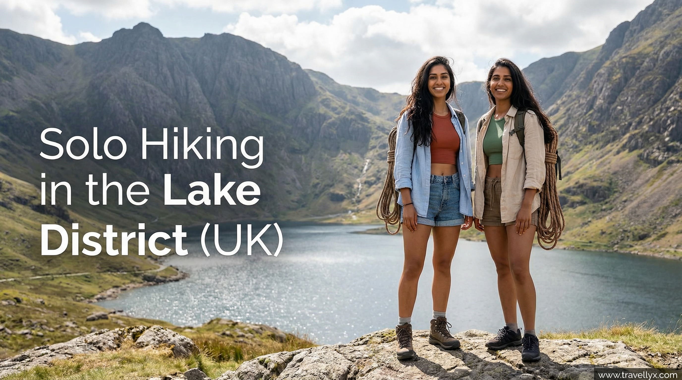
Solo hiking in the Lake District (UK) without a car
Are you dreaming of hiking the stunning Lake District fells but worried that not having a car will hold you back? Let me tell you right now: that myth ends here. As a solo female hiker who’s spent countless weekends hopping on the Stagecoach 555 bus and conquering peaks from Catbells to Helvellyn, I’m here to show you that car-free Lake District hiking isn’t just possible—it’s actually better.
Forget the stress of narrow country lanes, the disappointment of “car park full” signs at 8 AM, and the expense of parking fees. In this comprehensive guide, you’ll discover exactly how to solo hike the Lake District without a car in 2025, complete with detailed bus-to-boot instructions, the best solo-friendly trails, safety protocols, and insider tips that will transform your Lakes adventure.
Why Solo Hiking Without a Car is Actually Better
When I tell people I explore the Lake District without a car, I usually get puzzled looks. But here’s the beautiful truth that becomes obvious after your first bus-accessible hike: traveling car-free gives you a freedom that drivers simply don’t have.
Think about it. With a car, you’re tethered to wherever you parked. You have to start and finish in the same place, creating a circular route or retracing your steps. Without that constraint, you unlock what I call “linear freedom”—you can walk from Grasmere to Ambleside over the fells and simply catch the 555 bus back. No backtracking. No boring return journeys. Just pure forward adventure.
But the benefits extend beyond logistics. The journey on the open-top 555 bus becomes part of the experience itself. You’re not white-knuckling through narrow passes—you’re relaxing, taking photos, chatting with fellow hikers, and soaking in views that drivers miss entirely. Plus, you arrive at your trail fresh and energized, not stressed from navigating unfamiliar roads.
There’s also something deeply mindful about public transport hiking. You work within bus schedules, which naturally paces your day. You can’t rush. You can’t overextend. The last bus becomes a gentle nudge to finish before dark, adding just enough structure to keep you safe without feeling restrictive.
Essential Logistics: Getting In and Getting Around
Let’s get practical. The Lake District’s bus network might seem daunting at first glance, but once you understand the main arteries, it becomes incredibly simple. Here’s your transport masterclass.
The Gateway Stations: Your Starting Point
Most car-free hikers arrive via one of two main railway stations. Windermere Station (in the south) connects directly to the West Coast Main Line via Oxenholme, with regular services from London, Manchester, and Glasgow. It’s your best bet if you’re focusing on the central and southern Lakes. Penrith Station (in the north) sits right on the West Coast Main Line and provides access to the northern fells around Keswick and Ullswater.
From Windermere Station, the 555 bus stop is literally outside the front entrance. From Penrith, you’ll catch either the X4/X5 to Keswick or the 508 to Ullswater. Both stations have luggage storage facilities if you need to store a large backpack before hitting the trails.
The “Holy Grail” Bus Routes
The 555: Lancaster to Keswick via Windermere, Ambleside, and Grasmere. This is the backbone of car-free Lakes hiking. Running year-round with services every 30-60 minutes during peak season, the 555 connects virtually every major hiking hub in the central Lakes. Key stops include Windermere, Brockhole, Waterhead (for Ambleside), Rydal, Grasmere, Wythburn Church (for Helvellyn), Thirlmere, and Keswick. Many hikers call this one of the UK’s most scenic bus routes, and they’re not wrong.
The 599: The Open-Top Experience. Running between Bowness and Grasmere via Windermere and Ambleside, this seasonal service (Easter to November) offers that quintessential Lakes experience with the top deck open to mountain air. It departs every 20 minutes during peak season and includes spoken commentary about the landscapes you’re passing.
The 77/77A (Honister Rambler): This is the “scary” bus that conquers the high passes. Operating seasonally from Easter to October, it runs from Keswick through Borrowdale, over Honister Pass, and into Buttermere. If you want to reach the remote western valleys without a car, this is your lifeline. Note: Some sections may have limited service due to road conditions, so always check current timetables on the Lakes by Bus website.
The 78 (Borrowdale Bus): Another open-top service running between Keswick and Seatoller through stunning Borrowdale. Every 30 minutes from Easter to November, this bus accesses gems like Grange Bridge, Rosthwaite, and the Bowder Stone.
The 505/506: Coniston and Hawkshead. If you’re exploring the southern Lakes around Coniston Water, these services connect the area to Ambleside and Windermere.
The £3 Fare Cap: Your Budget Superpower
Here’s where car-free travel becomes financially unbeatable. As of 2025, single bus journeys across the Lake District are capped at just £3 as part of the government’s nationwide initiative. That means whether you’re going two stops or traversing the entire 555 route from Lancaster to Keswick, you’ll never pay more than £3 per journey. For context, that’s less than most Lake District car parks charge for a few hours.
Essential Apps: Your Digital Toolkit
Download these two apps before you arrive, and download your maps for offline use:
- Stagecoach Bus App: Real-time bus tracking is a game-changer. After finishing a hike, you can see exactly where your bus is and whether you need to hustle or can grab that extra coffee. You can also buy tickets directly through the app.
- OS Maps App: Essential for navigation. The Ordnance Survey maps show all footpaths, elevation, and landmarks. Download your route areas for offline use because phone signal on the fells is patchy at best.
I also recommend Traveline (traveline.info) for comprehensive journey planning across all bus operators in the Lakes.
Choosing Your “Base Camp” as a Solo Traveler
Location matters enormously when you’re car-free. You want to minimize your total travel time and maximize your hiking hours. Based on my experiences staying in various Lakes towns and countless conversations with fellow solo hikers, here are your best options.
Ambleside: The All-Rounder Champion
If I could only recommend one base, it would be Ambleside. This compact town sits at the literal crossroads of the Lakes bus network. The 555 stops right in the town center. The 505/506 to Coniston departs from here. The 599 connects you to Windermere. It’s central, walkable, and packed with outdoor shops, cozy cafes, and gear stores if you need last-minute supplies.
YHA Ambleside is my top pick for solo travelers. Perched right on the shores of Windermere with stunning lake views, this hostel has a vibrant social atmosphere perfect for meeting fellow hikers. The on-site bar and restaurant mean you can grab dinner and a pint without venturing far after a long day. Dorm beds start around £30-35 per night, while private rooms are £80-90. The hostel is literally 5 minutes from the 555 bus stop and 10 minutes from multiple trailheads.
Keswick: The Adventure Capital
Keswick is the queen of the northern Lakes. This market town provides access to iconic peaks like Skiddaw, Blencathra, and Catbells, plus the stunning Borrowdale valley. It’s more spread out than Ambleside but compensates with better access to the northern fells.
YHA Keswick sits beautifully on the banks of the River Greta, just minutes from the town center and the bus station. The hostel has a restaurant, self-catering kitchen, drying room (essential in the Lake District!), and that same welcoming atmosphere YHA is known for. Keswick’s Thursday and Saturday markets are wonderful for stocking up on local food, and the town has excellent outdoor shops and a climbing wall for rainy days.
Windermere/Bowness: The Beginner-Friendly Option
If this is your first Lakes adventure, Windermere offers a gentler introduction. You’re right at the railway station, surrounded by shops and restaurants, and within easy reach of less strenuous walks. YHA Windermere sits in gorgeous grounds overlooking the lake with panoramic mountain views. It’s slightly further from the town (2 miles) but regular buses connect you quickly.
| Location | Best For | Top Hostel | Avg. Dorm Price | Bus Connections |
|---|---|---|---|---|
| Ambleside | Central access, multiple routes | YHA Ambleside | £30-35 | 555, 505, 599 |
| Keswick | Northern fells, Catbells | YHA Keswick | £32-38 | 555, 77/77A, 78 |
| Windermere | Beginners, easy access | YHA Windermere | £35-40 | 555, 599, 6 |
| Grasmere | Quiet, central fells | YHA Grasmere Butharlyp Howe | £33-37 | 555, 599 |
Top 5 Solo-Friendly Hikes (Fully Bus Accessible)
These routes are specifically chosen for solo hikers using public transport. Each includes precise bus-to-boot instructions, difficulty levels, and solo safety considerations. I’ve personally done all of these hikes multiple times.
1. The Beginner’s Classic: Orrest Head (from Windermere Station)
Distance: 2.5 miles (4 km) circular | Time: 1.5-2 hours | Elevation: 239m (784ft)
Bus-to-Boot Instructions: Exit Windermere Station, turn right, and you’ll see a signposted footpath within 2 minutes. That’s it. No bus required beyond arriving at the station.
This short climb rewards you with the view that inspired Alfred Wainwright to dedicate his life to fell-walking. From the summit, you’ll see Windermere lake stretching below, the Langdale Pikes rising in the distance, and the rolling fells of the central Lakes. The path is clear, well-maintained, and never technically challenging.
Solo Safety Note: This trail is busy enough that you’ll encounter other walkers, yet never crowded. Perfect confidence-builder for first-time solo hikers. For more inspiration on solo female hiking adventures, check out our guide on solo female hiking in Switzerland.
2. The Iconic Ridge: Catbells (via Keswick Launch or 78 Bus)
Distance: 3.5 miles (5.6 km) circular | Time: 2-3 hours | Elevation: 451m (1,480ft)
Bus-to-Boot Instructions: From Keswick, you have two fantastic options. First, take the Keswick Launch boat from the lakeshore past Theatre by the Lake to Hawes End jetty (£5.50 one-way, boats every 30 minutes). This adds a delightful 10-40 minute water crossing to your adventure. Second, catch the 77 or 77A bus from Keswick bus station to the Hawes End stop (£3 single).
Catbells is the Queen of the easy peaks. Though relatively low, this distinctive fell provides ridge-walking thrills and 360-degree views across Derwentwater to Keswick, Skiddaw, and the Newlands Valley. The ascent involves some steep sections and minor scrambling near the summit, but nothing technical.
The Solo Adventure Layer: Taking the boat adds a unique dimension to solo hiking. You’re traveling by foot, bus, and water—it feels like a proper expedition. According to Keswick Launch, they’ve been operating since 1845, and the walkers’ tickets allow flexible return times throughout the day.
Practical Tip: After descending, either return to Hawes End for the boat, or extend your walk along the lakeshore to High Brandelhow (another launch stop) for different scenery.
3. The Linear Challenge: Grasmere to Ambleside via Loughrigg Fell
Distance: 5.5 miles (8.9 km) linear | Time: 3-4 hours | Elevation: 335m (1,099ft)
Bus-to-Boot Instructions: Take the 555 or 599 to Grasmere village center. Walk through the village toward White Moss Common, following signs for Loughrigg Terrace and Loughrigg Fell. The trail climbs steadily to the summit with panoramic views, then descends directly into Ambleside. Finish with a pint at The Flying Fleece or The Royal Oak, then catch the 555 back.
This is linear freedom in action. You genuinely walk from one valley to another, never retracing steps. Loughrigg Fell isn’t technically difficult but provides surprisingly spectacular views for its modest height. You’ll see both Grasmere and Windermere lakes from the summit, plus the surrounding peaks of Fairfield, Helvellyn, and the Langdale Pikes.
Solo Confidence Booster: The trail is well-worn and easy to follow. You’ll encounter families, dog walkers, and fellow hikers throughout. The sense of achievement finishing in a different town than you started is immense.
4. The “Big” One: Helvellyn from Thirlmere (555 Bus)
Distance: 10 miles (16 km) circular | Time: 6-7 hours | Elevation: 950m (3,117ft)
Critical Bus-to-Boot Instructions: Take the 555 and get off at Wythburn Church stop on the western shore of Thirlmere reservoir. This is essential. Do NOT attempt Striding Edge or Swirls Edge as a solo hiker unless you’re experienced and confident with scrambling. From Wythburn, take the Old Pony Track—a clear, non-technical path that zigzags steadily to the summit plateau.
Helvellyn, England’s third-highest peak at 950 meters, attracts over 250,000 visitors annually. The summit plateau provides humbling views across the entire Lake District and, on clear days, to Scotland and the Isle of Man. This is a serious mountain day requiring fitness, proper gear, and clear weather.
Solo Safety Protocol: Leave a detailed route card at your hostel. Download offline maps. Carry spare layers, emergency snacks, a charged phone with portable battery, a whistle, and a head torch. Check the Mountain Weather Information Service (MWIS) forecast the night before—if high winds or low visibility are predicted, reschedule.
From the summit, descend via the same route (safest for solo hikers) or loop back via Nethermost Pike for added adventure. The 555 has regular afternoon and evening services from Wythburn Church stop.
5. The Remote Beauty: Buttermere Circular (77/77A Bus)
Distance: 4.5 miles (7.2 km) circular | Time: 2-3 hours | Elevation: Minimal
Bus-to-Boot Instructions: From Keswick, take the 77/77A bus through Borrowdale, over Honister Pass, to Buttermere village (check seasonal timetable). Get off at the village, and the lakeshore path starts immediately.
Buttermere is often called the most beautiful lake in the district, and the circular walk around it showcases exactly why. With dramatic peaks rising directly from the water’s edge and waterfalls cascading down surrounding fells, this gentle valley walk feels worlds away from civilization despite being fully bus-accessible.
The Honister Pass Experience: The 77/77A bus journey itself is part of the adventure. Climbing over Honister Pass at 357 meters, this is one of Britain’s most scenic bus routes. The seasonal service typically runs Easter to October, but always verify current schedules on the Stagecoach website.
Solo Dining Option: The Bridge Hotel in Buttermere serves excellent pub food and welcomes solo travelers warmly. Perfect for lunch before your return bus.
The Solo Safety Net: Stay Safe on the Fells
Solo hiking requires extra caution, but with proper preparation, it’s absolutely safe. Here are the non-negotiables that have kept me (and countless other solo hikers) safe across hundreds of Lake District adventures.
Route Cards: Your Safety Insurance
Every single time you hike alone, leave a route card. This simple practice could save your life. Write down your planned route, expected return time, what to do if you’re late, and emergency contacts. Leave it with hostel reception, text a photo to a friend, or use the SaferGo app which allows GPS tracking.
What to Include: Your name, your phone number, your planned route with grid references, your expected return time (add 2 hours buffer), what you’re wearing, and who to contact in emergency. YHA hostels have physical route card forms at reception—use them.
The “No Signal” Strategy
Mobile phone coverage on the fells is sporadic at best. On Helvellyn’s summit? Maybe. Halfway up Catbells? Unlikely. In Borrowdale valleys? Forget it. This is why paper maps and downloaded offline maps are absolutely essential.
I carry both the OS Maps app (with offline downloads) and a physical OS Explorer map (OL5, OL6, or OL7 depending on location). The app is convenient, but paper doesn’t run out of battery.
Emergency Protocol: The 999 Text Service
Register your mobile for the emergency SMS service before you arrive. Text “register” to 999 and follow the instructions. This allows you to text emergency services when you have partial signal but can’t make voice calls—a common situation on the fells. Once registered, text 999 with your location (grid reference) and the nature of your emergency.
Learn to read grid references on your map. In an emergency, you’ll need to tell mountain rescue exactly where you are. The six-figure grid reference system is simple once practiced.
Weather Wisdom: Understanding MWIS Reports
The Mountain Weather Information Service provides specialized fell forecasts. Unlike general weather apps, MWIS tells you summit conditions, freezing levels, wind speeds, and visibility. Check it every evening before hiking.
My rule: If MWIS predicts summit winds over 50mph, I stay low. If cloud base is below 600 meters, I choose a valley walk. If rain is forecasted, I accept I’ll get wet but ensure I have spare dry layers. The Lake District weather changes rapidly—respect it.
Tell Someone Your Plans
Beyond route cards, use your phone’s location sharing. Share your live location with a trusted friend via WhatsApp, Find My iPhone, or Google Maps. They don’t need to actively watch you, but if you don’t check in by your expected return time, they can see where you last had signal.
This strategy proved invaluable when I twisted my ankle descending from Fairfield and my return was delayed by two hours. My friend saw I was moving slowly but steadily and didn’t panic unnecessarily. If you’re curious about safety protocols on other solo hiking destinations, our article on the Pekoe Trail for solo female travelers offers additional perspectives.
Packing List for the Car-Free Hiker
Your packing list differs from car-based hikers in one crucial way: everything must work for the “wait at the bus stop” moment. You’ve finished your hike, you’re sweaty, and the 5:15 PM bus arrives in 30 minutes. That scenario changes what you pack.
The “Wait-at-the-Bus-Stop” Layer
This is the most overlooked item in car-free hiking: a warm, packable jacket specifically for the post-hike bus wait. After sweating up a fell, your body temperature drops rapidly when you stop. Standing at a windy bus stop in damp clothes without a warm layer is miserable and potentially dangerous.
I carry a lightweight down jacket that stuffs into its own pocket. Once I finish hiking, I immediately pull it on over my damp base layer while waiting for the bus. On the warm bus, I remove it. Simple but essential.
Portable Power: Your Lifeline
Your phone is your bus ticket, your map, your camera, your emergency contact, and your entertainment. It cannot die. Carry a fully charged portable power bank (10,000mAh minimum) and keep your phone in airplane mode while hiking (except when you need maps) to extend battery life.
The Solo Hiker’s Complete Pack List
- Navigation: OS Maps app (offline), physical OS map, compass, portable charger
- Safety: Whistle, head torch, basic first aid kit, emergency blanket, 999 text registration
- Clothing: Waterproof jacket, waterproof trousers, warm post-hike layer, spare socks, hat, gloves
- Food/Water: 2 liters water minimum, lunch, emergency snacks (nuts, chocolate, energy bars)
- Documents: Bus tickets/app, ID, small cash (some rural cafes don’t accept cards)
- Comfort: Sunscreen, lip balm, blister plasters, hand sanitizer
Lightweight Nutrition: Restocking in Town
Keswick’s Booths supermarket and Ambleside’s Co-op are your best friends. Both stock excellent hiking snacks. Booths offers local Kendal Mint Cake (the legendary Lakes energy food), while Co-op has budget-friendly meal deals perfect for trail lunches.
For prepared sandwiches and packed lunches, try Ambleside’s Sheila’s Cottage (incredible homemade cakes) or Keswick’s Bryson’s Bakery. Both pack sandwiches perfect for backpacks.
Sustainable & Budget Tips
Car-free travel is inherently more sustainable, but you can enhance your eco-credentials further while saving money.
Eco-Travel Incentives
Several Lake District businesses offer discounts to walkers arriving by public transport. The National Trust properties including Wordsworth’s Dove Cottage and Hill Top (Beatrix Potter’s house) give small discounts when you show bus tickets. Some cafes in Ambleside and Grasmere offer 10% off to customers who arrive by bus or bike—always ask.
Supermarket Hacks: Booths vs. Co-op for Solo Hikers
For solo budget hiking, here’s the breakdown. Co-op (Ambleside, Keswick, Windermere) offers the best value for single portions. Their meal deals (sandwich, drink, snack for £4) are perfect for trail lunches. Co-op also has excellent bakery sections with budget-friendly pastries and energy bars.
Booths (Keswick, Windermere) is more upscale but worth it for special treats. Their local cheese selection, Cumbrian sausages, and deli counter are excellent for hostel cooking. Booths also stocks proper outdoor snacks like Kendal Mint Cake, flapjacks, and Grasmere Gingerbread.
My budget strategy: Shop Co-op for daily essentials and lunches, Booths for one or two special treats each trip.
Free Activities Between Hikes
Rest days don’t need to be expensive. Walk around Keswick’s Derwentwater shoreline (free), visit Castlerigg Stone Circle (free, stunning views, accessible by foot from Keswick), explore Ambleside’s Bridge House (free, iconic photo spot), or wander Grasmere village and cemetery where Wordsworth is buried (free).
Keswick’s Thursday and Saturday markets offer local food, crafts, and people-watching. Window-shopping outdoor gear stores like Cotswold Outdoor and George Fisher is entertainment in itself for hiking enthusiasts.
Frequently Asked Questions
Absolutely! The Lake District has an excellent bus network, particularly the 555 service connecting Lancaster to Keswick. With the £3 single fare cap, you can reach most major hiking spots affordably and sustainably. Thousands of hikers explore the Lakes car-free every year.
Both are excellent! Ambleside is more central with multiple bus junctions, perfect for accessing southern fells like Loughrigg and Fairfield. Keswick is ideal for northern peaks like Catbells and Skiddaw, plus Borrowdale valley. YHA hostels in both locations are fantastic for meeting fellow travelers. If choosing one, Ambleside edges ahead for first-timers due to its central location.
Yes, with proper preparation. The Lake District is generally very safe, with well-marked trails and frequent hikers. Always leave a route card at your hostel, download offline maps, register for the 999 Text Service for emergencies, and stick to popular trails when solo. The hiking community is welcoming and supportive.
Single fares are capped at £3 as part of the 2025 government fare cap initiative. For unlimited travel, the North West Explorer ticket costs £12 per day. This makes car-free travel extremely affordable compared to parking fees (£5-10 per day) and fuel costs.
Orrest Head from Windermere Station is perfect for beginners—it starts literally 2 minutes from the train platform, takes about 1.5 hours round trip, and offers stunning views that inspired Alfred Wainwright. Catbells from Keswick is another excellent beginner option, reachable by boat or the 77 bus.
The main 555 route runs year-round, though with slightly reduced frequency from November to March. Seasonal routes like the 77/77A Honister Rambler typically operate Easter to October only. Always check the winter timetables on the Stagecoach website before planning winter trips.
Always check the last bus time before starting your hike and build in at least a 90-minute buffer. If you do miss the last bus, most hostels can help arrange local taxis. Keep emergency taxi numbers saved: Keswick Taxis (017687 72676), Ambleside Taxis (015394 33254). A taxi between main towns costs £15-25.
Your Journey Starts at the Platform
Standing on Windermere Station platform with your backpack, watching the 555 bus pull up, you might feel a flutter of nervousness. That’s normal. Solo hiking without a car feels like stepping into the unknown. But here’s what I wish someone had told me before my first Lakes adventure: you’re about to discover a freedom that car-bound hikers never experience.
You’ll hop off a bus at a tiny stone church, walk up into clouds, emerge on a summit with views stretching to Scotland, descend into a valley you’ve never seen before, and catch another bus home. You’ll chat with fellow hikers about routes and weather. You’ll time your descents by bus schedules, adding gentle structure to your wanderings. You’ll arrive home tired, accomplished, and already planning your next adventure.
The Lake District belongs to everyone, not just those with cars. With the £3 bus fare, excellent hostel networks, and well-maintained footpaths, solo hiking these ancient fells is more accessible than ever. The mountains don’t care how you arrived—they only care that you came prepared, respectful, and ready for adventure.
So download those apps, book that hostel, pack that bag, and buy that bus ticket. Your Lake District adventure starts the moment you step onto that platform. The fells are waiting, and trust me—they’re even better than you imagine.
Quick Reference: Essential Resources
- Bus Information: Stagecoach Bus
- Train Booking: National Rail
- Accommodation: YHA Hostels
- Weather Forecasts: Mountain Weather Information Service
- Maps: OS Maps App
- Journey Planning: Traveline
- Keswick Launch Boats: Keswick Launch
- National Trust Properties: National Trust
Ready for your next adventure? The Lake District awaits you, and every summit is just a bus ride away. Pack your boots, download your maps, and embrace the freedom of car-free fell-walking. See you on the trails!